
A Lake in the Hills Address Trail Across Record Eras
Previous residents require sources that overlap in time and purpose. Deeds name parties to land transfers, while a directory, newspaper, census, or permit may add an occupant or household clue. The table keeps those roles separate.
| Source | Documented span | Where to consult it | What it may show |
|---|---|---|---|
| Recorder land index and images | 1839 to current effective date, as stated by county | Free Web Search, Laredo Anywhere, Tapestry EON, Recorder office | Grantors, grantees, dates, instruments, legal descriptions |
| Township assessor books | 1850 to about 1960 | McHenry County Historical Society | Taxable owner and property description |
| County maps and atlases | 1862, 1872, 1892, 1908 and later mapped sets | MCHS and local libraries | Landowner, road, farm, and plat context |
| County and regional directories | 1877, 1892, and documented later regional runs | Woodstock library, AAPLD, MCHS | Dated name, township, post office, address, or occupant leads |
| Haines criss-cross | 1977 onward in Woodstock library description | Woodstock Public Library and regional references | Address-to-name lead when that volume covers the area |
| Local newspapers and obituary index | Collection-dependent | AAPLD, IDA, and library holdings | Moves, deaths, family, events, and last-address clues |
Begin with Athena and the newest deed for a modern Lake in the Hills house. For land that predates modern street numbers, begin with the PIN, plat, section, or township description.
Walk the McHenry Deed Chain Back from Lake in the Hills
The Recorder index is the core owner trail. Its party, document number, recording date, document type, PIN, address, subdivision, and associated-document fields support a backward search, while the instrument image supplies the proof.
The McHenry County Recorder Free Web Search provides the documented free starting point for the index.
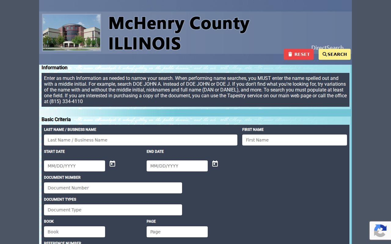
The captured search screen shows why names, dates, and parcel details must be saved before following each transfer back another step.
- Open Athena and save the current owner result, PIN, situs, subdivision, and legal description.
- Find that owner's purchase deed and confirm the buyer as grantee and the parcel description as a match.
- Take the seller or grantor from that deed and search that name as the grantee on an earlier purchase.
- Repeat the handoff, checking recording dates, legal descriptions, lot and block, and later conveyances at each link.
- When an online image is absent, use the Recorder's office, copy channels, IRAD catalog, or MCHS paper bridge.
A deed result may also list a book and page, consideration clue, subdivision, image status, or associated filing. A mortgage, release, lien, or plat can explain the parcel, but does not by itself show a transfer.
- Grantor and grantee
- The grantor transfers an interest; the grantee receives it.
- Chain of title
- The linked sequence of recorded transfers for the same land.
- Legal description
- The formal land description used to confirm the parcel when street labels change.
- Criss-cross directory
- An address-arranged volume used as a dated occupancy lead, not final proof.
Lake in the Hills PINs Solve the Address-Continuity Trap
Lake in the Hills has two broad address eras: township, farm, post-office, and section references before incorporation, and Village street or situs addresses after 1952. The PIN, subdivision lot, and legal description are more durable than either label.
No official year-by-year Lake in the Hills renaming or renumbering schedule was located. Do not force an old source into a modern number. Compare the deed description with plats, mapped parcel shape, neighboring owners, and the later Athena record. Search older forms such as Lake in Hills, Algonquin Township, Woods Creek, Indian Trail, Hilltop, Crystal Lake Road, Pyott Road, and Haligus Road.
Note: A ZIP or tax mailing city is a delivery clue, not proof that an old parcel lay within Village limits.
Maps and Assessor Books Before Lake in the Hills Street Numbers
MCHS and local libraries document county maps and atlases from 1862, 1872, 1892, and 1908, plus later Hixson, Stacy, Rockford, and Sidwell sets. These can place an owner, road, farm, subdivision, or section where no modern address appears.
Township assessor books from 1850 to about 1960 add taxable-owner and property-description clues. The 1892 resident directory and plat book records business, township or village, post office, birth, nativity, and arrival-in-county fields. The 1877 county directory adds taxpayer, voter, township, business, and biography context, though its subscription model may leave gaps.
This older layer matters because Lake in the Hills did not yet exist as a Village. McHenry County was organized in 1836, and the county seat moved to the Woodstock area in 1844. Early books are therefore found through county or township custody, not a Village directory shelf.
Research Past Lake in the Hills Homes at MCHS and Woodstock
The McHenry County Historical Society research library holds maps, tax records, subject files, photographs, obituaries, biographies, plat maps, telephone directories, yearbooks, and local histories. Visits require an appointment Tuesday through Friday from 9:00 a.m. to 3:30 p.m.
A remote request should state the names, dates, homestead location, and work already done. The documented nonmember research fee is $30 before work begins, with a typical wait of three weeks or more; copies and scans cost extra. Members and McHenry County K-12 students are exempt from that research fee.
The Woodstock house-history guide also recommends linking property, map, directory, newspaper, and government records. These holdings can extend the previous residents trail when a web index ends, but a Woodstock record must not be mislabeled as a Lake in the Hills record.
Sanborn and Permit Limits for Lake in the Hills House History
Sanborn fire-insurance maps can show footprint, material, use, and old street labels, but the documented nearby runs are for Crystal Lake and Woodstock. No confirmed Lake in the Hills Sanborn series was found. Use those maps only when the property actually falls within their coverage.
For a Lake in the Hills structure, the Village Public Portal includes selected permits, inspections, and code matters. No all-years public permit cutoff was documented. Request older material by address, PIN, project type, applicant or contractor if known, and date range. A permit date marks work, not proof that the named person lived at the site.
The Village's civic-office trail also illustrates why a name and date matter: offices moved from 55 Hilltop to 1111 and later 1115 Crystal Lake Road, then to 600 Harvest Gate. That is a paperwork timeline, not evidence of a broad street renumbering.
Pair Lake in the Hills Directories, Census Years, and Obituaries
Owners are only one layer of previous residents. A criss-cross volume can connect an address to a dated name where the volume includes Lake in the Hills. A census schedule can identify a household, and an obituary or probate file can explain a later departure or transfer.
- Write down the exact address form, source year, PIN, and subdivision from the deed and map trail.
- Check the nearest covered directory year, including Haines volumes from 1977 onward where inclusion is verified.
- Pair that lead with the nearest public census schedule, allowing for enumeration boundaries and the 72-year release rule.
- Search AAPLD's Algonquin Area Obituaries Index, Cardunal Free Press, and Northwest Herald materials by name and date.
- For an estate transfer, search the 22nd Circuit case portal and request the public probate documents needed to confirm the link.
The 1890 federal census was destroyed in the 1921 fire. County directories, plats, deeds, assessor books, and newspapers can bridge that gap. The broader shelf is described on the Lake in the Hills city directories page.
When the Lake in the Hills Previous Residents Trail Ends
Obituaries can name relatives and a last community, while probate can identify an estate role and land transfer. Neither source proves that every named person occupied the house. Confirm the address, date, role, and parcel against the deed chain.
Previous residents research also has firm privacy bounds. Protected addresses, sealed adoption records, DMV data, private utility accounts, and private group rosters are not ordinary house-history sources. A current owner's mailing address may point away from the property and should not be republished as an occupancy claim.
Lawful use. Use past resident records for family history, estate research, and personal house history. Never use them to track, threaten, harass, or harm a living person.