
Walk a Lake in the Hills Street Directory from Address to Archive
A current Lake in the Hills address can reveal a parcel owner and a chain of public land records, but it cannot promise a full household list. This street directory workflow treats the PIN and legal description as the thread that joins county and Village sources.
- Enter the exact house number and street in McHenry County Athena. Save the PIN, situs, owner result, mailing address, subdivision, and legal description.
- Browse the same street on the Athena map. Select same-street parcels and record each PIN without treating map labels as occupant proof.
- Run the current owner and PIN through the Recorder index, read the purchase deed, and confirm its legal description.
- Use wEdge house-number ranges for dated tax context, then ask the Village for permits or inspections tied to the address.
- Use voter tools only for a person's own self-match. For an older household lead, consult a covered Haines criss-cross volume.
If Athena finds nothing, test a directional prefix, abbreviation, older road label, subdivision, or nearby postal city. Preserve the date of each result because parcel, tax, and permit data change.
Lake in the Hills Street Search Fields in Athena and wEdge
The two county systems accept different address clues. Athena establishes the parcel and map context. The Treasurer's wEdge system can scan a house-number range and adds tax-year or sales context. Neither system is a census of Lake in the Hills residents.
| Portal mode | Field or control | Input style | Use by street |
|---|---|---|---|
| Athena Parcel | PIN | Exact parcel text | Stable link to map, tax, and deed records |
| Athena Address | House and street address | Address text | Find the situs parcel and check municipality |
| Athena Owner | Owner name | Name variants | Find associated parcels, not household members |
| Athena Subdivision | Subdivision and lot context | Text or selection | Resolve duplicate or changed street labels |
| wEdge Address | House number low/high, street, city | Text and range | Scan tax records along a number range |
| wEdge Advanced | Class, township, district, tax years | Selections | Narrow results and preserve the tax year |
The McHenry County Treasurer wEdge search is shown in this captured reference.
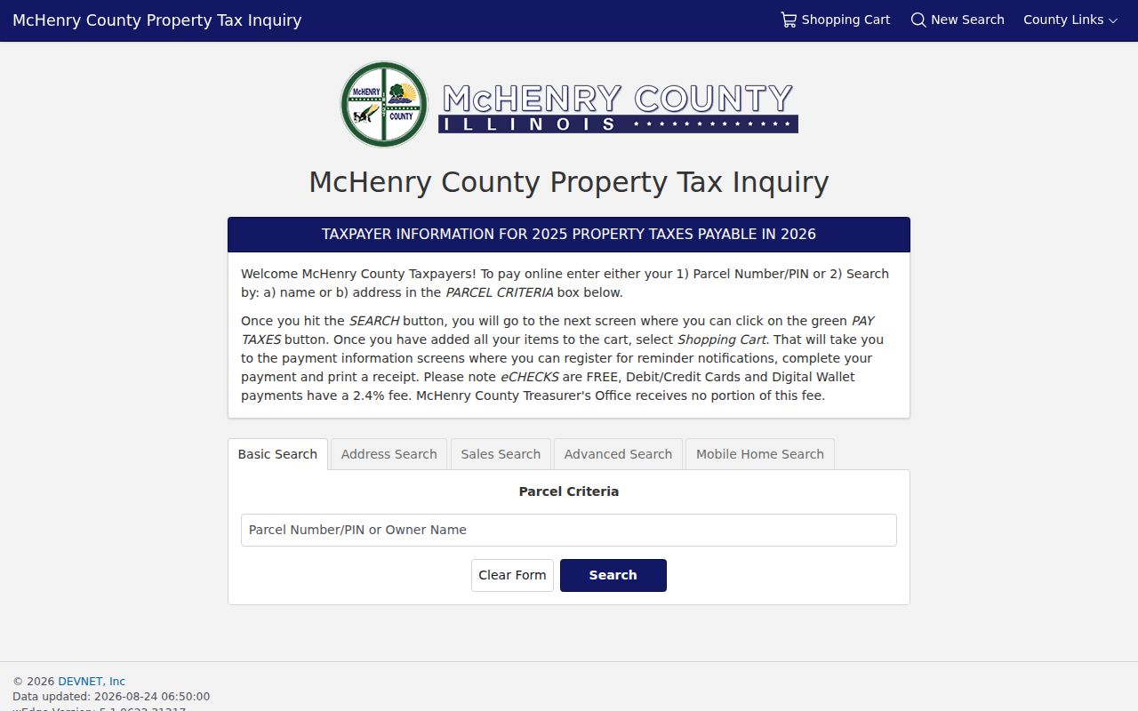
The interface illustrates why a searcher must save the selected mode, criteria, tax year, and result date before adding a row to a street directory. Sales filters can point to an event, but the recorded deed is the source to inspect before drawing a conclusion.
Map Lake in the Hills Parcels with Athena Tools
Athena turns one address into a by-street worklist. Parcel Text, Parcel Sales, City, Subdivision, flood, soil, waterway, fire-district, and topography layers add context to each mapped lot.
Property Information opens a parcel card. Buffer can select an area, Measure adds distance or frontage context, and Export CSV can save supported results. Tri-View, Image, XY Coordinates, Navigation, Remove All, and Clear help manage the map. A buffer is a spatial selection, not proof of who occupies the selected homes.
- Parcel or PIN
- The county identifier that connects assessment, tax, map, and recorded-instrument research.
- Situs address
- The physical location assigned to the parcel, distinct from the tax mailing address.
- Plat
- A recorded map that places a lot and block within a subdivision.
- Criss-cross directory
- A volume arranged by address or phone number that can supply a dated occupant lead.
Owner, Situs, and Mailing Clues on a Lake in the Hills Street
The Athena Details tab is described as showing the PIN, situs, and owner name. Its Miscellaneous tab adds last-sale and legal-description clues, while post-2011 documents may appear under Documents. Earlier documents are directed to the Recorder.
A tax mailing address tells where correspondence goes. It may be an office, a relative's address, or another parcel. The situs says where the land sits. For any street directory row, retain both fields and never turn a tax-mail recipient into an assumed resident.
Note: Athena's post-2011 document access does not replace the Recorder index or the need to inspect the recorded instrument.
The McHenry Recorder Trail Along Lake in the Hills Roads
The Recorder says its online index and images extend from 1839 to the current effective date, with depth varying by document and image class. Search by party, document number, recording date, type, PIN, address, subdivision or tract, and associated document.
Start with the current owner's purchase deed. Confirm that person as grantee, then use the seller or grantor as the next earlier grantee. Repeat, matching the PIN or legal description at every step. Mortgages, liens, releases, plats, and transfer declarations are related events, but they are not all ownership transfers.
The free web search supplies an index route, Laredo Anywhere offers expanded paid searching, Tapestry EON is pay as you go, and office or request channels supply copies. The Recorder will not perform a title search or give legal advice.
Lake in the Hills Address Records Compared by Street
A useful street directory assigns each claim to the source built to hold it. The PIN links most property sources, while the exact street format and date help with permits and historic references.
| Address-keyed source | Public clue | Keeper | Best next check |
|---|---|---|---|
| Athena parcel search | PIN, owner, situs, mailing, map, sale and legal-description tabs | McHenry County Assessments/GIS | Recorder instrument and Treasurer tax record |
| wEdge address range | Tax and sale context by number range, street, and city | McHenry County Treasurer | Confirm parcel and tax year |
| Recorder address, PIN, or subdivision | Deeds, mortgages, liens, plats, parties, dates | McHenry County Recorder | Read the instrument and legal description |
| Village Public Portal or FOIA | Selected permits, inspections, licenses, and code matters | Lake in the Hills | Request by address, PIN, type, and date range |
| Historic criss-cross and maps | Dated occupant or old parcel lead where covered | Woodstock library, AAPLD, MCHS, IRAD | Verify volume coverage and original record |
Illinois voter self-match is intentionally absent as a browse source: it confirms one person's own record and is not an open street roster.
Permits and Code Clues by Lake in the Hills Address
The Village Public Portal covers selected building permits, contractor and business licenses, inspections, and code complaints. Online permit categories named by the Village include air conditioning, furnaces, roofing and siding, water heaters, and water softeners.
No all-years public permit index was found. Ask Community Development or use Village FOIA with the address, PIN, project type, known applicant or contractor, and issue, final, or inspection date range. Private contact details, drawings, or protected enforcement material may be redacted.
Older Lake in the Hills Streets Need Township and Plat Clues
Lake in the Hills incorporated in 1952, so early records often use Algonquin Township, a post office, farm section, subdivision, or nearby community instead of the later Village address. Historic search terms include Woods Creek, Indian Trail, Hilltop, Crystal Lake Road, Pyott Road, and Haligus Road.
The county's 1862, 1872, 1892, and 1908 maps and township assessor ledgers from 1850 to about 1960 can bridge land to a later street. The 1877 county directory and 1892 resident and plat book add names and township or post-office context. No verified Lake in the Hills street-renumbering schedule was found, so this page does not invent one.
For the collections and access rules, see the Lake in the Hills city directories guide.
Build a Reliable Lake in the Hills Street Worklist
A long road should be researched one parcel at a time. Give each row a house number, PIN, situs, subdivision, Athena result date, and source link. Add the owner result in its own column, then place the tax-mail name, recorded deed parties, permit references, and dated directory leads in separate columns. That structure prevents one type of address record from being mistaken for another.
Sort the worklist by house number or PIN, not by surname. Flag vacant or combined lots, trusts, estates, duplicate names, and parcels that span more than one tax line. If a street crosses a municipal edge, turn on the City layer and check the situs, township, and postal label. The words Lake in the Hills on a mailing record alone do not establish that the parcel lies within the Village.
For every document, retain its date and role. A deed names a grantor and grantee; a plat maps land; a mortgage secures a debt; a permit records a project; a directory supplies a dated name lead. This disciplined street directory is slower than copying search results, but it makes each conclusion traceable and exposes gaps before they spread across the full road.
Where a Lake in the Hills Street Directory Must Stop
No official Lake in the Hills street directory shows every household member, visitor, private utility customer, protected voter, or person whose record uses another mailing label. Parcel owners, tax-mail recipients, permit applicants, and address occupants may all be different people.
Illinois voter registration lookup is a self-match. Central electronic voter data has strict access and use limits, including a screen-view restriction during the 27 days before an election. DMV addresses, private association rolls, and protected records are not ordinary street-search layers.
Lawful use. Use address records for lawful personal, family, property, and civic research. Never use a Lake in the Hills street search to stalk, harass, threaten, or expose a protected person.